

Horry County 7-Day Weather Forecast: Saturday October 31, 2026
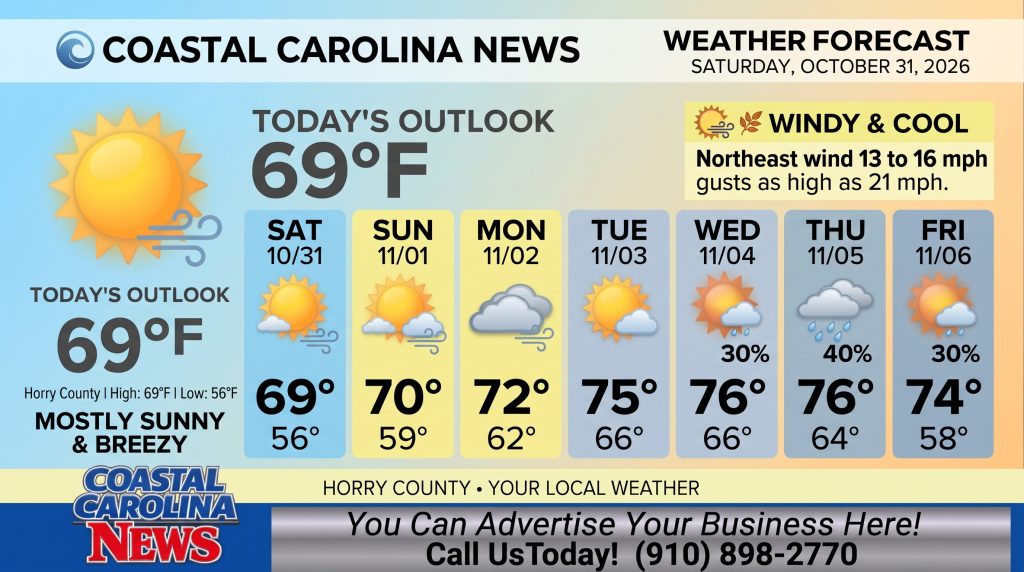
Horry County will experience cool, breezy, and mostly sunny conditions for Halloween Saturday, with high temperatures reaching near 69 degrees and strong northeast winds gusting up to 21 mph. Cloud cover will increase tonight and remain elevated through early next week before rain chances enter the forecast starting Wednesday.
Horry County Detailed Forecast
-
Today: Mostly sunny, with a high near 69. Northeast wind 13 to 16 mph, with gusts as high as 21 mph.
-
Tonight: Mostly cloudy, with a low around 56. Northeast wind around 15 mph, with gusts as high as 21 mph.
-
Sunday: Partly sunny, with a high near 70. Northeast wind around 15 mph, with gusts as high as 22 mph.
-
Sunday Night: Mostly cloudy, with a low around 59. Northeast wind 14 to 16 mph, with gusts as high as 22 mph.
-
Monday: Mostly cloudy, with a high near 72. Northeast wind 13 to 16 mph, with gusts as high as 23 mph.
-
Monday Night: Mostly cloudy, with a low around 62.
-
Tuesday: Partly sunny, with a high near 75.
-
Tuesday Night: Partly cloudy, with a low around 66.
-
Wednesday: A chance of showers after 2pm. Partly sunny, with a high near 76. Chance of precipitation is 30%.
-
Wednesday Night: A chance of showers. Mostly cloudy, with a low around 66. Chance of precipitation is 30%.
-
Thursday: A chance of showers. Partly sunny, with a high near 76. Chance of precipitation is 40%.
-
Thursday Night: A chance of showers. Mostly cloudy, with a low around 64. Chance of precipitation is 30%.
-
Friday: A chance of showers. Mostly sunny, with a high near 74. Chance of precipitation is 30%.
Safety Precautions & Preparedness Guidelines
-
Halloween Outdoor Activities & Wind Safety: Sustained northeast winds of 13 to 16 mph with gusts up to 21 mph will persist throughout the day and evening. Trick-or-treaters should dress warmly as temperatures drop into the mid-50s tonight, and residents should ensure lightweight Halloween decorations are securely anchored.
-
Coastal Waterways & Driving: Strong winds through Monday (gusting 21 to 23 mph) may create rough surf conditions along beaches and minor tidal push along the Intracoastal Waterway. Use caution when driving high-profile vehicles on coastal bridges.
© 2026 CoastalCarolinaNews.com | Jones Media Partners LLC
No content from this publication may be reproduced, republished, or used for commercial purposes without prior written authorization from Jones Media Partners LLC. For questions or comments call 910.898.2770 or you can reach out via our Contact Page.

Be the first to comment