

Coastal Flood Advisory Active for Horry County
CONWAY, SC — Coastal Horry County is under a Coastal Flood Advisory this morning as high tides threaten low-lying causeways, tidal waterways, and roads along the Intracoastal Waterway. Up to one foot of inundation above ground level is expected, particularly around the morning high tide. Drivers heading toward local beaches should exercise caution, allow extra commute time, and never drive through flooded roadways.
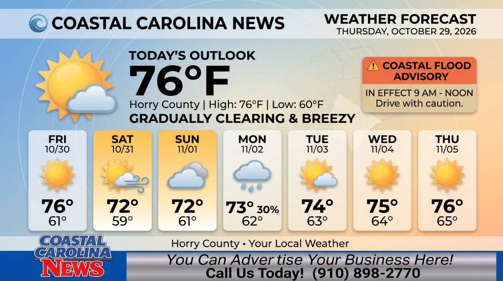
Horry County Detailed Forecast:
-
Today: Mostly cloudy, then gradually becoming sunny, with a high near 76. Northeast wind 10 to 13 mph, with gusts as high as 18 mph.
-
Tonight: Mostly clear, with a low around 60. Northeast wind 5 to 7 mph.
-
Friday: Sunny, with a high near 76. North wind 6 to 8 mph becoming east in the afternoon.
-
Friday Night: Partly cloudy, with a low around 61. Calm wind becoming northeast around 6 mph after midnight.
-
Saturday: Partly sunny, with a high near 72. Northeast wind around 14 mph, with gusts as high as 21 mph.
-
Saturday Night: Mostly cloudy, with a low around 59.
-
Sunday: Mostly cloudy, with a high near 72.
-
Sunday Night: Mostly cloudy, with a low around 61.
-
Monday: A chance of showers before 2pm. Partly sunny, with a high near 73. Chance of precipitation is 30%.
-
Monday Night: Mostly cloudy, with a low around 62.
-
Tuesday: Mostly sunny, with a high near 74.
-
Tuesday Night: Partly cloudy, with a low around 63.
-
Wednesday: Mostly sunny, with a high near 75.
Breezy northeast winds will keep temperatures comfortable in the mid-70s through Friday, with a slight dip into the low 70s over a windier weekend. A minor 30% chance of rain enters the picture early Monday afternoon before sunshine returns to round out next week.
Safety Precautions & Preparedness Guidelines
-
Roadway Safety: Avoid driving through standing water on causeways and low-lying coastal roads. Obey all barricades and traffic re-routes. Allow extra travel time during morning high tide cycles.
-
Ocean & Beach Safety: Strong northeast winds will elevate surf and create hazardous swimming conditions. Keep clear of flooded beach access points and follow all local beach advisory signs.
© 2026 CoastalCarolinaNews.com | Jones Media Partners LLC
No content from this publication may be reproduced, republished, or used for commercial purposes without prior written authorization from Jones Media Partners LLC. For questions or comments call 910.898.2770 or you can reach out via our Contact Page.

Be the first to comment